Ormesby's housing, old and new
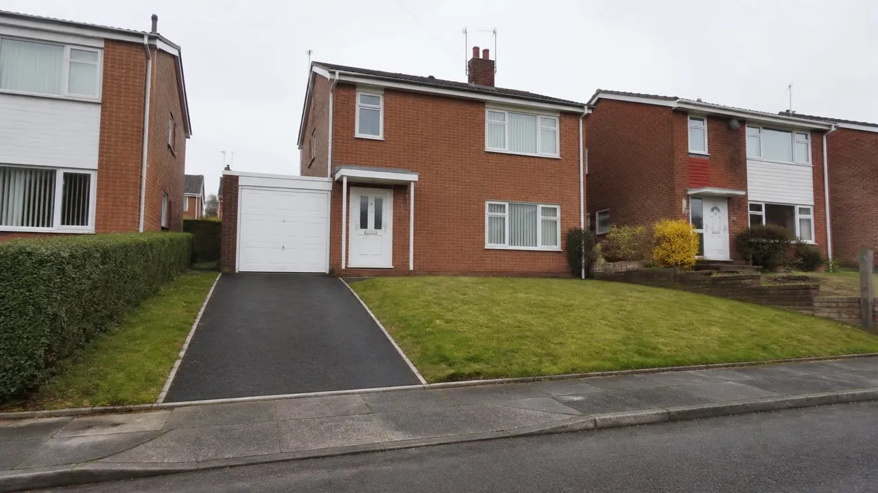
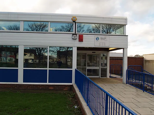
Ormesby falls in the TS7 postcode district. The old village is strung along the High Street, where the cottages at 33 to 55 High Street are Grade II listed, along with the Queen Victoria Jubilee Memorial and St Cuthbert's Church. Ormesby Hall, a mid-18th-century house, is Grade I listed together with its stable block. Around this core, 20th-century estates spread over the farmland towards Normanby Road, Ladgate Lane, Cargo Fleet Lane and up Ormesby Bank. Schools include Ormesby Primary and Outwood Academy Ormesby, and the library sits near the roundabout.
Because the boundary runs through it, census figures depend on which side you look at. The Ormesby ward of Redcar and Cleveland, covering the eastern side, had households that were 50% semi-detached, 26% detached, 18% terraced and 6% flats in 2021. About 74% were owner-occupied and 38% had two or more cars or vans. The western side, including postcodes such as TS7 9AF, falls in Middlesbrough's Park End and Beckfield ward, where more homes are rented.
The typical Ormesby driveway situations are:
- Estate semis with a single side drive that owners want to widen for a second car.
- Detached houses on the slopes, where the drive rises or falls from the road and levels need planning.
- Cottages and older houses in the village core, with stone or brick walls along the street.
- Concrete or tarmac drives laid when the estates were built, now cracked or uneven.
Clay, slopes and Middle Beck
The British Geological Survey maps Ormesby on glacial till over Redcar Mudstone, a Jurassic mudstone. Both are slow-draining, so water from a new hard surface needs a planned route. Ormesby's slopes add to this, because water runs downhill towards houses or the road unless the drive is laid with proper falls and, where needed, a channel drain at the bottom.
Middle Beck runs through the area, and the Environment Agency's flood map shows Flood Zone 2 and 3 land within about 300 metres of the centre along it. Homes near the beck should check the map for their postcode. On sloping clay plots, permeable surfaces help only if the base below is designed for clay, so drainage needs thinking through for each garden.
Two councils, two conservation areas
Which council? Ormesby was split between Middlesbrough and what is now Redcar and Cleveland in 1974. Your council tax bill shows which applies. The difference affects:
- Planning. Each council handles applications for its own side, though the national front-garden rule is the same. More than five square metres of new hard surface draining onto the road needs planning permission, while permeable or self-draining surfaces do not.
- Dropped kerbs. On the Middlesbrough side, you need a vehicle pavement crossing licence before work. The 2026/27 fees are £25.50 to assess and £173.40 for the licence, and the work must follow the council's specification, by a contractor with £5 million public liability cover who maintains it for two years. On the Redcar and Cleveland side, apply through the council's online dropped kerb application. Its page does not publish a fee, so check the current charge when you apply.
Conservation areas. There are two: the Ormesby Conservation Area around the village and High Street, and the Ormesby Hall Conservation Area around the hall and its parkland. In either, removing walls or hedges at the front, felling trees or using materials that clash with the street can need consent or notice. Listed buildings and their curtilage also need listed building consent for relevant works.
Our dropped kerbs page explains crossings in more detail.
Ormesby driveway costs
Checkatrade's April 2026 UK cost guide puts installed driveways at about £60 per m² for gravel, £90 for tarmac, £100 for block paving and £120 for resin bound.
For an Ormesby semi widened to fit two cars, about 30m² in total, that would mean roughly £1,800 for gravel, £2,700 for tarmac, £3,000 for block paving or £3,600 for resin bound. A longer sloping drive to a detached house, about 55m², would be roughly £3,300 to £6,600.
Sloping sites cost more than flat ones of the same area. Retaining edges, steps, extra sub-base and channel drains all add labour and materials. Removing old concrete, matching a cottage wall, kerb works and the council's fees should also be allowed for.
Block paving copes well with slopes and can be laid with drainage channels. Tarmac suits long runs up Ormesby Bank. Resin bound is smooth and permeable, though on a steep slope it needs careful specification.
Nearby areas
- Nunthorpe: to the south, also split between the two councils, with more detached homes and the Nunthorpe and Poole conservation area.
- Park End: directly west, an estate of semis and terraces where most households rent.
- Marton: to the south-west, with large plots, Stewart Park and the Marton Village conservation area.
See all areas on our areas page.
Questions people ask in Ormesby
Is my Ormesby house in Middlesbrough or Redcar and Cleveland?
Ormesby has been split between the two councils since 1974. The western side, including postcodes such as TS7 9AF, is in Middlesbrough, while the eastern side forms Redcar and Cleveland's Ormesby ward. Your council tax bill confirms which council handles your planning and dropped kerb.
How do I apply for a dropped kerb on the Redcar and Cleveland side?
Redcar and Cleveland Council takes dropped kerb applications online through its roads and parking pages. It does not publish the fee there, so check the current charge when you apply. On the Middlesbrough side, the crossing licence costs £25.50 to assess and £173.40 to issue.
Can I change the front wall of a High Street cottage?
Possibly, but with care. The cottages at 33 to 55 High Street are Grade II listed and sit in the Ormesby Conservation Area, so works affecting their character can need listed building consent as well as planning advice. Speak to the council before planning any change.
Does a sloping Ormesby drive need special drainage?
Usually. Ormesby sits on slow-draining clay over Redcar Mudstone, and a slope sends water towards whatever is at the bottom. A channel drain across the foot of the drive, connected to a soakaway or suitable drain, is a common solution.
Sources: ONS Census 2021, Ormesby ward, Redcar and Cleveland (TS044, TS045, TS054 via Nomis); postcodes.io (ONS Postcode Directory): TS7 9AF, Middlesbrough; Historic England: Ormesby Hall (Grade I); 33 to 55 High Street (Grade II); planning.data.gov.uk: Ormesby and Ormesby Hall conservation areas; BGS Geology Viewer, 1:50,000; Environment Agency flood map for planning; Middlesbrough Council: vehicle pavement crossing licence; Middlesbrough Council fees and charges 2026/27; Redcar and Cleveland Council: dropped kerbs; Checkatrade driveway cost guide (April 2026).